Description
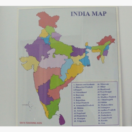
This meticulously designed political map of India features precise markings of all states and union territories, along with their capitals. It also highlights major cities and important geographical landmarks, making it an excellent tool for teaching students about India’s diverse political divisions and geography. The map’s large size and clear labels ensure that students can easily read and analyze the information, fostering a better understanding of India’s political structure and regional distinctions.
Available for supply across Hyderabad and Telangana, the “India Political Map” by Safa Teaching Aids is an invaluable addition to any educational setting. It aids teachers in delivering engaging and informative lessons, enhancing students’ spatial thinking and knowledge of India’s political geography.
Visit safateachingaids.com to explore our wide range of educational tools designed to support and enrich the teaching and learning experience. Equip your classroom with this high-quality India political map and inspire your students to explore and understand the complexities of India’s political landscape.


Reviews
There are no reviews yet.