Description
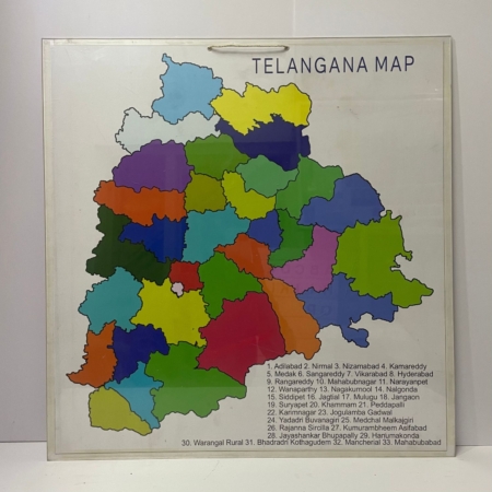
This teaching aid is ideal for social studies and geography lessons, enabling students to explore and comprehend the political structure of Telangana. The detailed markings clearly delineate district boundaries, major cities, and key administrative regions. The map’s interactive design allows for easy labeling and customization, making it perfect for engaging classroom activities such as identifying district capitals, significant landmarks, and political subdivisions.
Safa Teaching Aids is dedicated to delivering high-quality educational products that foster effective learning. The robust acrylic construction ensures longevity, making the “Telangana Political Map” a reliable resource for regular classroom use. By providing a tangible and engaging learning experience, this tool helps students grasp complex political concepts and enhances their understanding of regional governance and administrative structures.
Available through safateachingaids.com, the “Telangana Political Map” is an essential addition to any educational setting. It promotes active learning and helps students develop a comprehensive understanding of Telangana’s political geography, preparing them for advanced studies in social sciences, political science, and regional planning.



Reviews
There are no reviews yet.